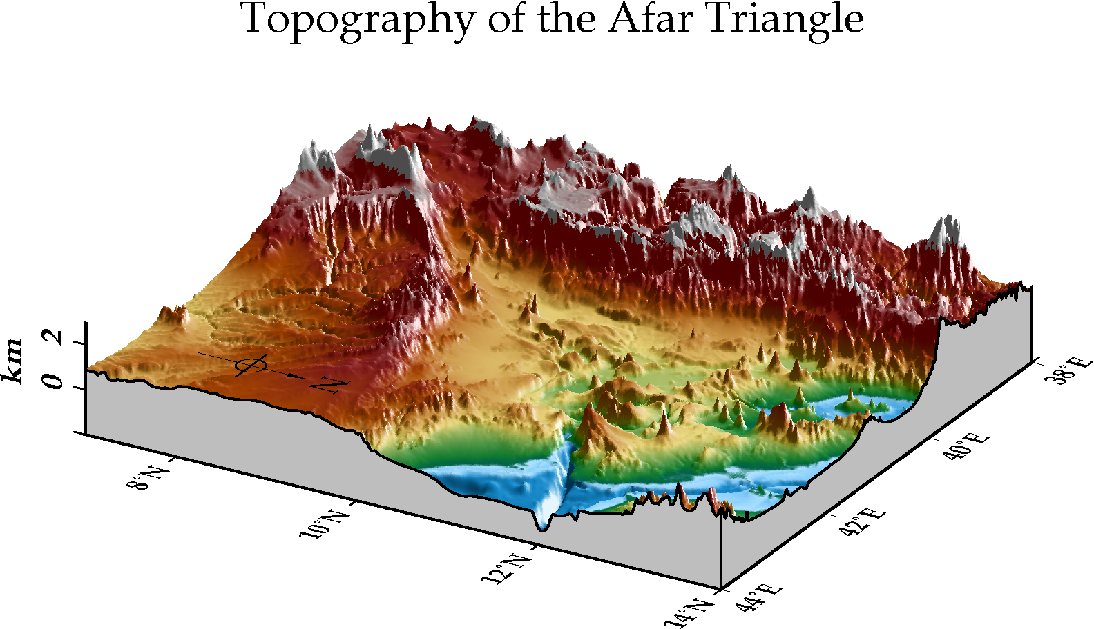
15. 3D Map
15.2. Commands and Techniques
gmtset- 更改 GMT 的預設作圖參數grdcut- 裁剪網格檔grdgradient- 計算網格檔的梯度與照明值psxy- 輸出檔頭與檔尾psbasemap- 製作 3-D 底圖與添加地圖元素grdview- 繪製 3-D 視圖psconvert- 把 ps 檔轉成 png 檔
15.3. Tasks before plotting
15.4. Procedure
15.5. Script
The final script for our map is:
in_grd="ETOPO1_Bed_g_gmt4_Afar.grd"
in_shadow="ETOPO1_Bed_g_gmt4_Afar_shadow.grd"

out_ps="afar.ps"

font="12p,31,black"
font_title="15p,29,black"

gmtset MAP_FRAME_TYPE=plain \
       FONT_ANNOT_PRIMARY=$font \
       FONT_LABEL=$font \
       FONT_TITLE=$font_title \
       FORMAT_GEO_MAP=dddF

# 製作輸入檔
# grdcut ../ETOPO1_Bed_g_gmt4.grd -R25/55/-5/25 -G$in_grd
grdgradient $in_grd -G$in_shadow -A295 -N10

psxy -R0/1/0/1 -JX1c -T -K -P > $out_ps

psbasemap -R38/44//7/14/-2/3 -JM3i -JZ0.6i -O -K -p60/25 -B2 -Bz2+lkm -BsEwNZ >> $out_ps

grdview ETOPO1_Bed_g_gmt4_Afar.grd -R38/44//7/14/-2000/3000 -I$in_shadow -J -JZ -O -K -p -Cmby.cpt -N-2000+ggray -Qi500 >> $out_ps

psbasemap -R -J -JZ -O -K -p -TdjRB+w1.5c+l,,,N+o2c/0c >> $out_ps
psbasemap -R0/1/0/1 -JX4.5i/2.5i -O -K -B+t"Topography of the Afar Triangle" >> $out_ps

psxy -R0/1/0/1 -JX1c -O -T >> $out_ps

psconvert $out_ps -A -P -Tg
Note
「」
Check the final map

